
AutoCAD – Where am I? Relate a Map to the Design
You want to show your client how the changes to your design will relate to what is there on the ground right now. To enable this you can backdrop your design with an aerial photo. But how do you relate the position on a map to the elements in your design?
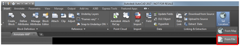
There is a feature in AutoCAD called Set Location which can be found on the Insert Tab. This allows you to import a placemark from a KML or KMZ file that a surveyor or GIS operator has sent you. Alternatively you can pick a known point on the map using the From Map option.
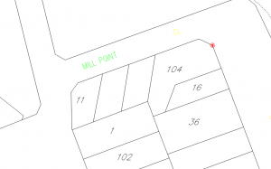
NOTE: The location stored in a KML, or KMZ file can be viewed using the Free Google Earth Viewer. The location of the mark is recorded as a Latitude and a Longitude value. The image below shows the boundary edge in Google Earth.
So with the location on the corner of a Lot Boundary in the file, you then need to locate the related position to the file on your drawing.
So now we have established a link between the mapping coordinate location, and our design. With this set the Geolocation Tab in AutoCAD opens up.
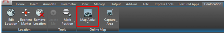
From the tab shown above you can choose to display an Aerial photo map, or a Map of roads, or a hybrid inside AutoCAD.
NOTE: You need to be logged into your A360 account to access the Map data.
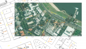
The Capture Area button allows you to take an image snapshot from the Aerial Photo. This is automatically related in the layout, see below. It reduces the aerial photo to just the area you selected, and is saved to the file even after you have turned the display of the map off.
Finally then, to detach the map, you click the Map Aerial button, and choose Map off.
